Panama Canal (January 9, 2017)
Note the crooked path even through the lake. Constant dredging is needed - the landslides that bedevileded the canal builders continue. Canal is 48 miles long.
Today, the sun came up over the Pacific and will set over the Atlantic! A result of the isthmus of Panama curving back on itself resulting in the canal running from the northwest (Atlantic) to the southeast. Of course I had to be on hand at 5A to see the breakwater that protects the canal. But I could do that from my balcony. They serve Panama Rolls on deck starting about 6A.This is a sweet roll that at first glance looks like an ordinary roll until you bite into it. In the center is a sort of apricot jelly and they are good!
I did not see the Pilot enter the ship. This is one place where the Captain must relinquish complete control of his vessel to another. These pilots hold a master’s license, have been captain of a large ship, then had a 3-year apprenticeship.
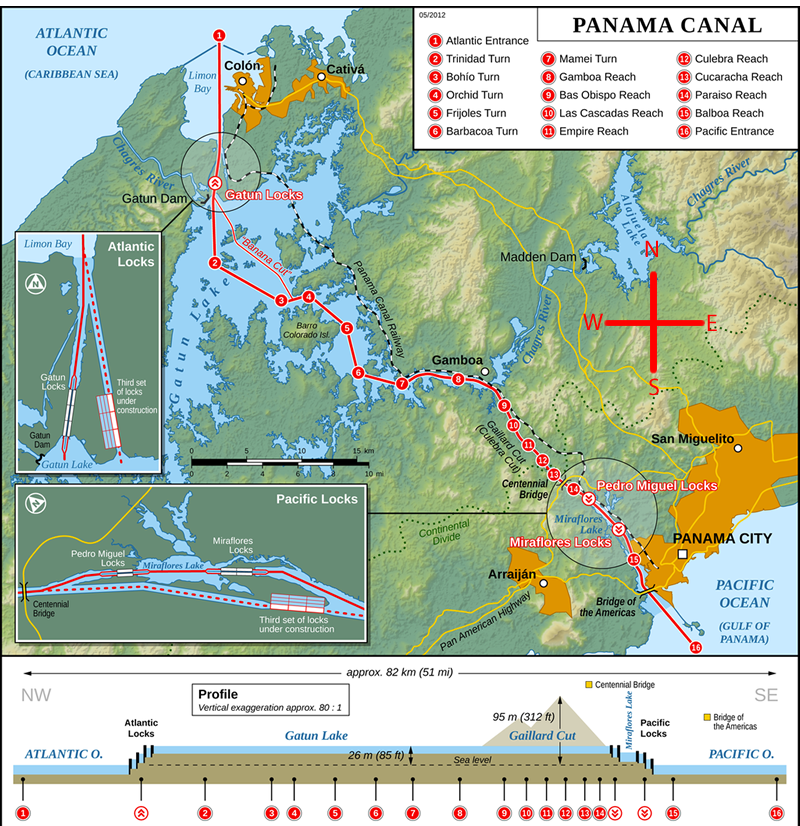
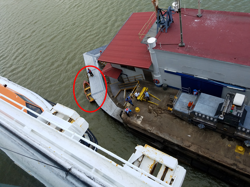
The first locks on the Atlantic side are the three Gatun Locks which we entered about 6:40. Although each ship goes through the canal on its own power, the speed is such that it is not steerable. To keep us centered 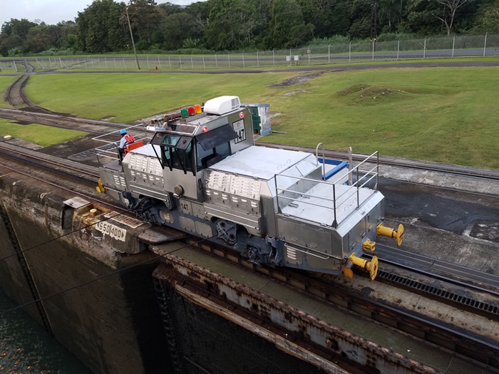 in a lock (there was only about a foot on each side of the ship), mules are used. (No, not the mules of the early canals, but I suspect that they took their name from them,) Six mules for each ship, two to the bow (one of each side) two a little further back that also attach to the bow (spring lines boaters call them) and of course two in the stern. When we get to the end of a lock, the mule rings a bell and the ship tosses the “lines,” really heavy wire, into the canal which the mule retrieve with a boat hook. (Note the high-tech row boat which is used to bring lines to the ship.)
The tariff for passenger ships is based on total berths which includes crew as well as passengers. Then there is the slight problem of a reservation which again costs. Our fee was over $300,000. Fees must be paid 48 hours in advance in cash!!! Incidentally the cheapest fare every paid was in 1924 when a swimmer paid $.36.
On the starboard side of a ship going from the Atlantic to the Pacific, once one leaves the last lock one can see Gatun Dam which is large and has 15 spillways which are often opened during the rainy season. I won’t bore you with the history of the building of the canal, 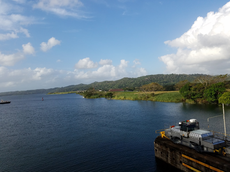
but I can say that it is fascinating. If you want to read about it, get a copy of David McCoullogh’s book, “Path Between the Seas.” The new canal which just opened in July of last year of course takes larger ships. The new canal is just 5 larger locks. We could see the end of it with a ship just emerging as we left our last lock.
Once we left the locks we were in Gatun Lake. There we had to anchor for several hours because the passage where the lake narrows is too narrow for two ships. An LPG ship coming towards us had the right of way! Do not know why!
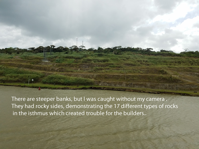
The Culebra Cut (formally called the Gaillard Cut after the man who directed the hard work to create this cut.) still requires dredging. Landslides did not stop when the canal was open. You can see it in the lower right of the map above.
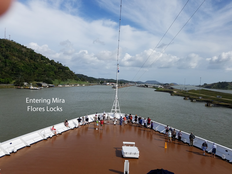
The last locks are the Mira Flores Locks of which there are only 2. The end of the canal is marked by the Bridge of the Americas. Because of our 2 hour anchorage it was dark before we passed under it, hence no pic!
The Mira Flores Locks which are on the Pacific 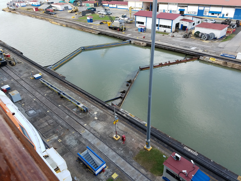
side are a little different, with double lock doors.