Malta April 9, 2017
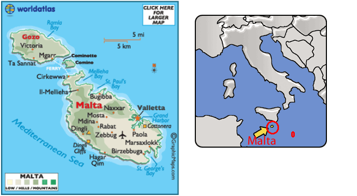
Malta, officially known as the Republic of Malta, is a Southern European island country consisting of three archipelagos in the Mediterranean Sea. They are 50 miles south of Italy, 176 miles east of Tunisia, and 207 miles north of Libya. The country covers just over 122 sq miles, with a population of just under 450,000, making it one of the world's smallest and most densely populated countries. Only two of the islands are inhabited, the largest of these is Malta.
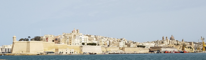
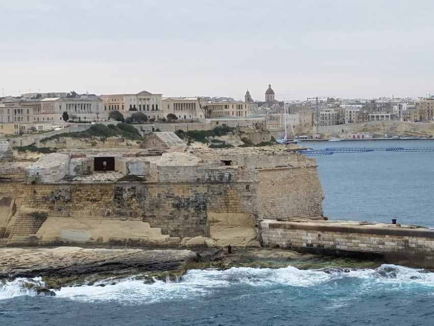
We entered Malta Harbor about 7AM. The night before the captain had said that we should all be up and watching because it is a spectacular harbor and he was right. There are fortifications on either side, now not in use. One of the many sights entering the harbor.
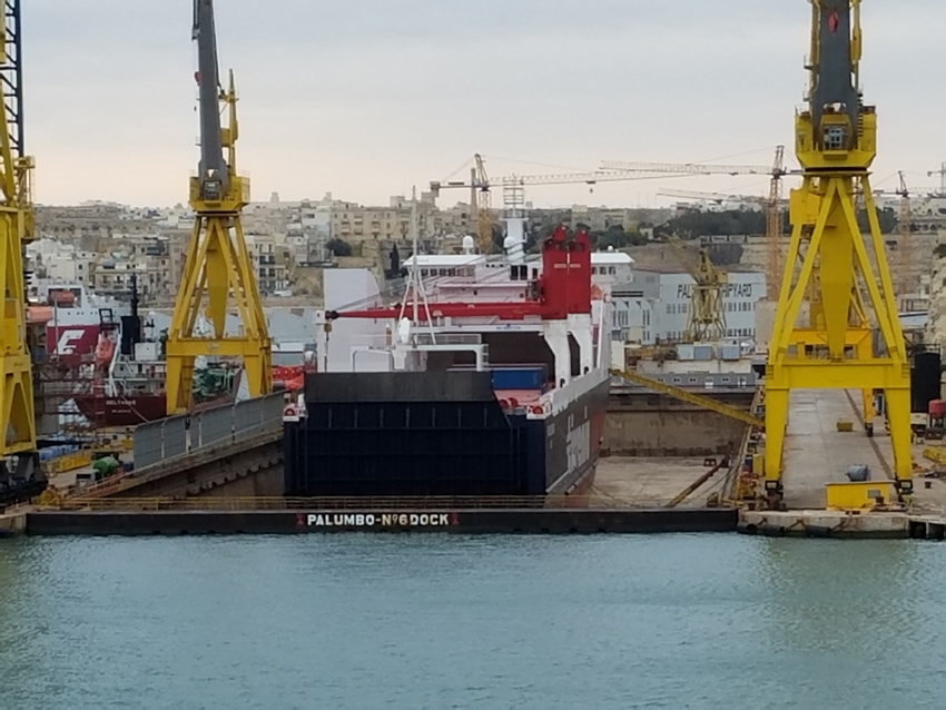
This harbor is also used as a place to repair fish farms, oil rigs, and ships. Across from where we moored was a ship in dry dock. Although it was completely dry when we entered the harbor by the time that we returned from our day tour it had been partially filled ready to refloat the ship.
The capital of Malta is Valletta, which is the smallest national capital in the European Union, and where the port is. Most of the city itself is on a hill 300 Meters (about 985 feet) high. There are roads up to it, but also an elevator that will transport you to the city for 1 euro. Most of Malta, at least what we saw, is high above the Mediterranean, although there are some nice beaches. The weather, being in the low 60s, cloudy, and windy we were not disappointed to not visit them.
Malta has two official languages: Maltese and English. Malta's location and deep harbor, has made it of great strategic importance as a naval base. Like all of the Mediterranean islands it has seen a succession of powers, including Phoenicians, Carthaginians, Romans, Moors, Normans, Sicilians, Spanish, Knights of St. John, French and British, rule it. It received independence from Great Britain on Sept 21, 1964.
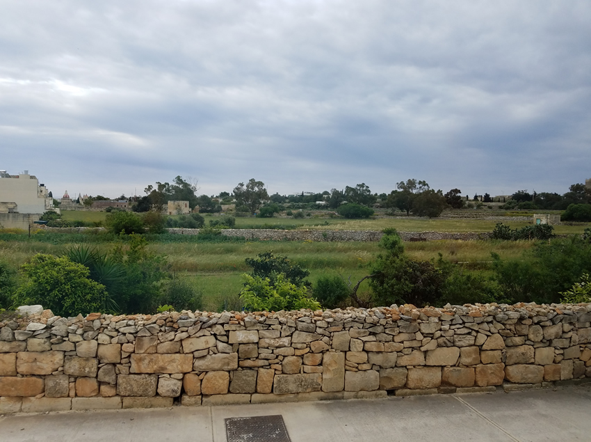
Stone walls such as these were seen everywhere in the countryside. It is possible that these field were once quarries, but then filled and dirt put over them, and reused for agriculture.
This is a very dry country with only about 16 inches of rain a year. They desalinate the sea for water, but advise people, including residents, not to drink it from the tap. There is irrigation for agriculture, but the water is either from a well or from a cistern in which rain water was collected.
The harbor at Valetta is a double harbor, that is there is a narrow peninsula which separates two fingers of the harbor. They are protected by two forts which date back to the Knights of Malta, who at one time were the “rulers” of Malta. This happened when the Holy Roman Emperor, Charles V, leased them the island for the payment of one Maltese falcon per year… Remember the movie…
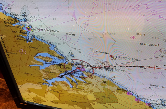
Above is a picture of the chart showing the two harbors and multiple fingers where boats are protected.
Recent history is tied up with the Knights of St, Johns whose order, interestingly, started in Jerusalem where they were hospitaliers to Christian pilgrims to Jerusalem. The Turks threw them out and numerous other places until they arrived in Malta where they successfully, during 2 sieges, kept the Turks from occupying the island.
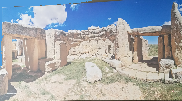
But to go back even further, Malta is the home of the remains of a 5500 year old structure, Hagar Qim, on the north side of the island. There is no written history, but archaeologists starting in 1839 (yes, 18) uncovered ruins of what look like temples. The island is full of limestone and huge pieces of this rock were used to make what it is believed are temples. When you see the stones there you have a difficult time believing that such ancient cultures could manipulate such rocks and build with them. It is surmised that this was a site of temples where people from neighboring islands came, maybe once a year, to pray (remember, we are putting 21st century ideas on this). But, how did they navigate here? Way too much is unknown, but it is fascinating to see the ruins.
What has been uncovered is under a large tent like structure to protect it from the elements. There was pottery found here, which they carbon dated to determine the age of the structures. But no tools were found, only round stones which they have guessed were used to facilitate moving these huge pieces of rock to this site by rolling the rock over them, a forerunner of a wheel, except they needed many round rocks. What caused the destruction of the temples is not known, it could have been an earthquake or ??? Where the people went is also a mystery. One of our group posited that aliens came and scooped them up, which is as good a theory as any. As you look at the photo below remember that these stones weighed tons, not pounds.
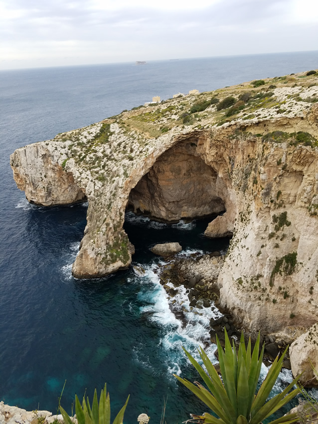
Malta island is also home to its “Blue Grotto,” water caves that extend from the sea. We saw them from above. Although in decent weather boats take visitors into them, the day that we were there the wind was howling about 45 mph (or more) and no one was venturing in.
Malta suffered during WW II from 433 continuous days of bombing by the Italians and Germans. It was British held and was used to harass the Axis supply lines to Northern Africa. The port city of Valetta was virtually demolished. The bombers came from Sicily which is only about 55 miles from here. However, only 1500 civilians on the island were killed due to two things, catacombs and an early warning system.
Although they had radar, the closeness of Sicily meant that by the time the bombers registered on the radar they were about overhead. However, there was a wall where the Maltese. by putting their ear to this wall (named of course, the ear wall), could hear the bombers starting their engines and get the citizens into the catacombs where they were safe. Although Valetta has been completely rebuilt, trying to redo what was originally here, in the countryside one can still see remnants of the bombing in ruined buildings.
The city of Rabat, more in the center of the island, fortunately was not of strategic importance thus had minimal bombing. It has many of the 365 churches on this tiny island, most of which are Roman Catholic, a remnant of the Knights. There are also innumerable shrines and many, many, religious statues throughout the island. Because Rabat is a medieval town, there are many small streets that are fun to walk.
There are also convents. In one we saw the remains of an opening in which unwanted babies could be placed for care by the nuns. Although not in use here today, we were told that in Eastern Europe there are still some places that are meeting this need. As we were leaving Valeletta on our way to the Blue Grotto, I saw a nun in complete black habit – it’s been years since I had seen that.
While in Rabat it turned noon and the church bells began to sound - surprisingly none chimed the full 12, just a lot of noise. With the narrow streets there was quite an echo
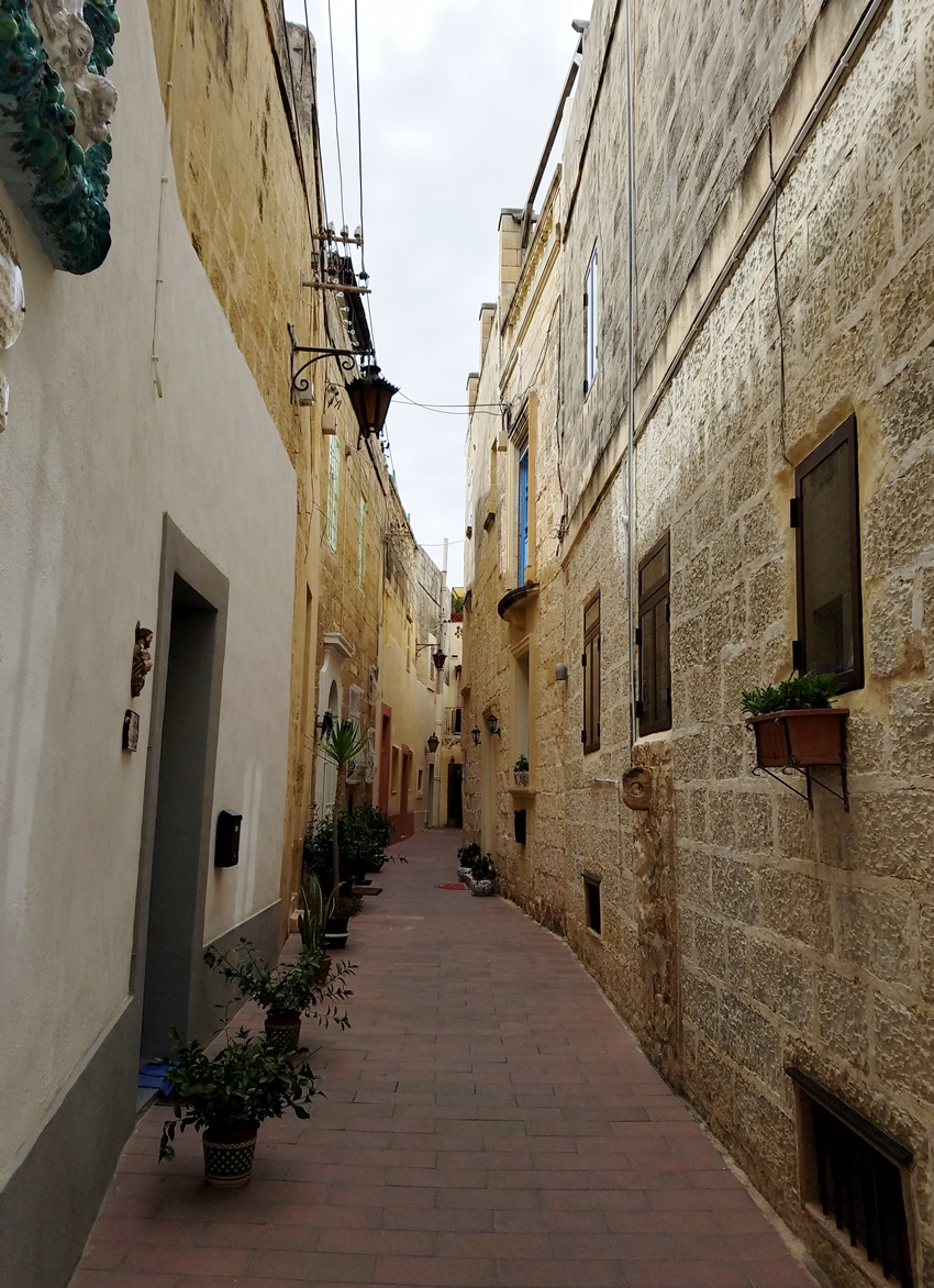
Rabat also houses what was once the capital of Malta, the medieval city of Mdina (pronounced Medina). It is a walled city with a moat that was never filled. People still live here and there is one home where one family had lived for over 800 years.
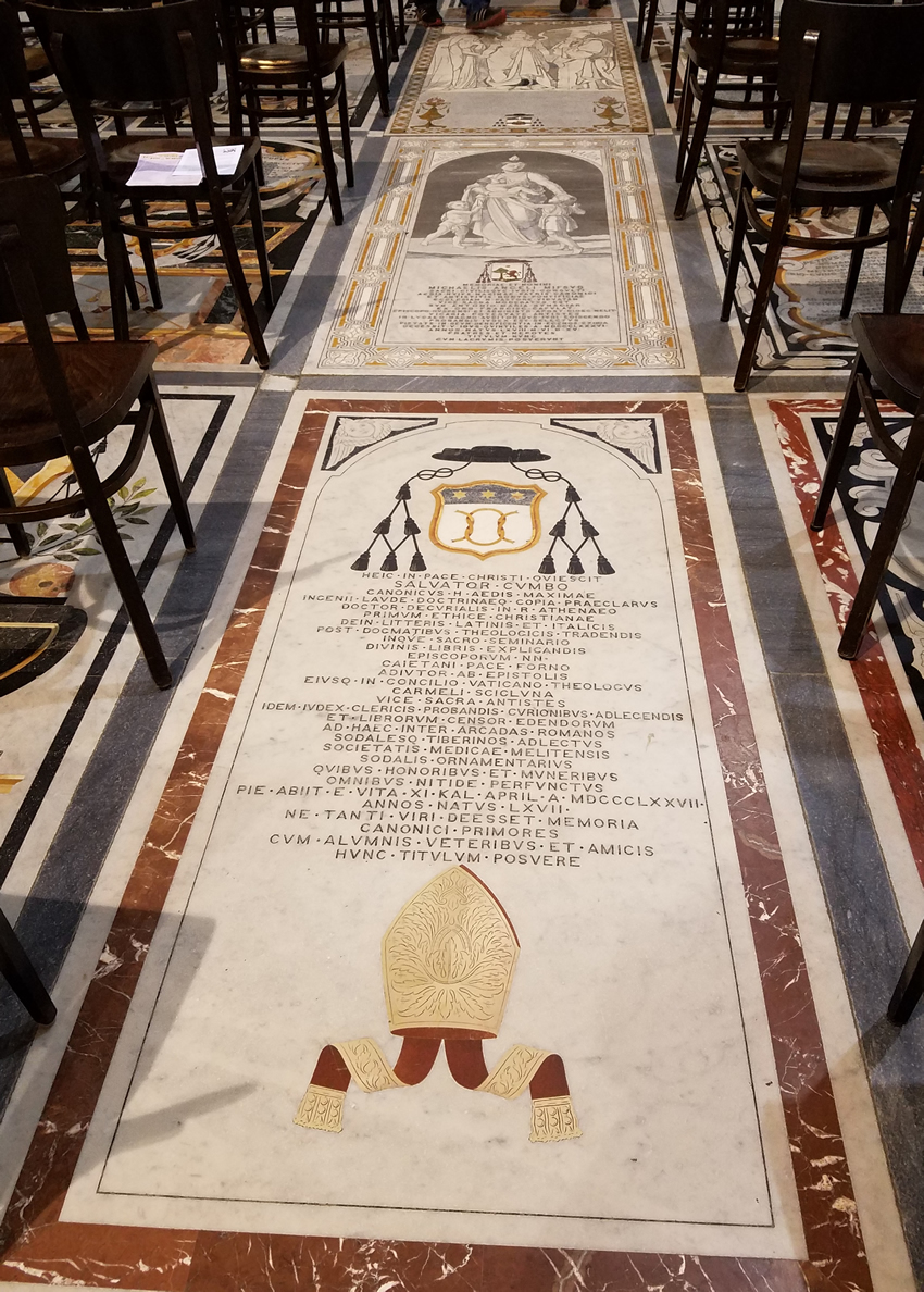
In Mdina is the Cathedral of Malta, or the Cathedral of St. Paul. The floor is large tiles that each have a Latin message on them. Women are not permitted to wear high heels here to protect the tiles. (The same is true in the Cathedral in Valetta.)
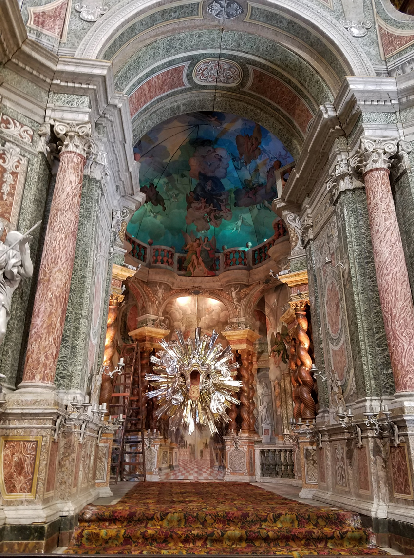
There is one section there that is all made of wood (see below). The item at the end is solid silver.
And so we leave another beautiful Mediterranean island.