Majuro Marshall Islands - February 2
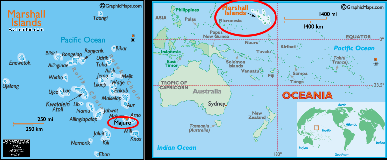
Overall map of Pacific Islands
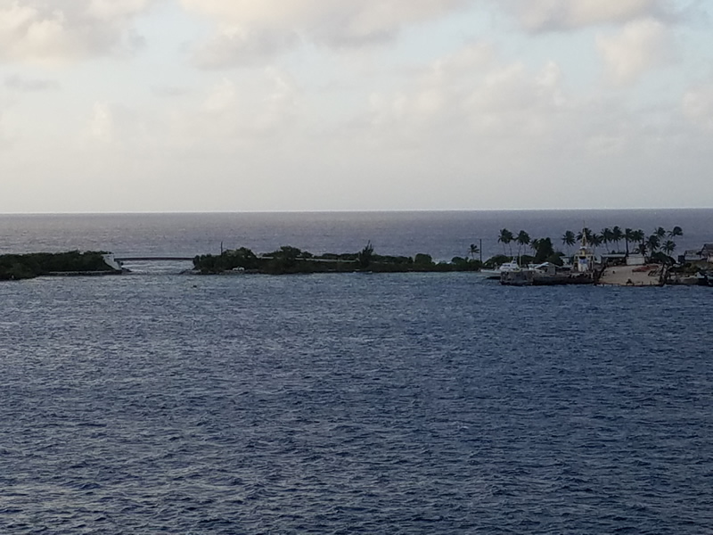
The first part of Majuro that I saw was a long, narrow piece of land with some palms and what looked like tall, scrawny evergreens.
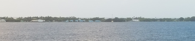
As we progressed the 14 miles through the harbor into our port at Delap, I saw a few buildings and an occasional car.
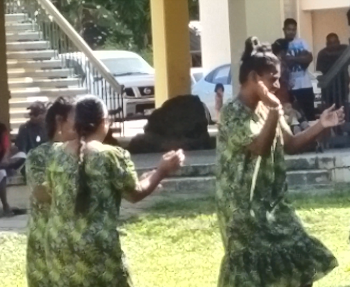
On this narrow strip of land is a two land road running the length of the four main islands that are linked by bridges. Our trip into the village passed both decent looking buildings as well as run down ones, not unlike any city. The islanders were delighted to have us visit. While we were there, in the middle of De Lap there were islander women dancing to peppy music. Woven souvenirs were for sale at a roadside stand, but no one accosted you.
There were volunteers to assist the visitors and they wore T-shirts saying, "Welcome MS Amsterdam to Majuro." Rumor has it that we were the first cruise ship to visit in two years. Given that even Road Scholar had no separate tours there, nor did the ship, that may be understandable. But the islanders were uniformly friendly.
We were all impressed when we stood at the side of the road obviously wanting to cross non-stop traffic. Cars in both directions simply stopped to allow us to cross. No horns or signs of impatience. As soon as we had crossed the cars proceeded and easily again created a non-stop line of traffic.
The Republic of the Marshall Islands consists of 1,156 islands better called atolls. An atoll is a coral reef that built up on the sides of a volcano. Eventually the volcano becomes so heavy that it depresses the plate below it and sinks leaving a rounded, narrow land feature of coral. Atolls are usually not complete circles because the coral in some spots is not that strong and breaks up. For this same reason atolls are apt to consist of separate islands like Majuro does. Many have a good lagoon, which provides safe harbor for ships.
The capital of the Marshall Isalnds is Majuro. It is composed of 64 islands, four of which have been joined together with a bridge. Majuro has a land area of 3.7 sq. mi and encloses a lagoon of 114 sq. miles. The Marshall Islands are part of what is known as Micronesia, separate from Melanesia (islands to the south) and Polynesia (Hawaii to Easter Island to New Zealand). Each of these island groups has different cultures and the natives emanated from different areas.
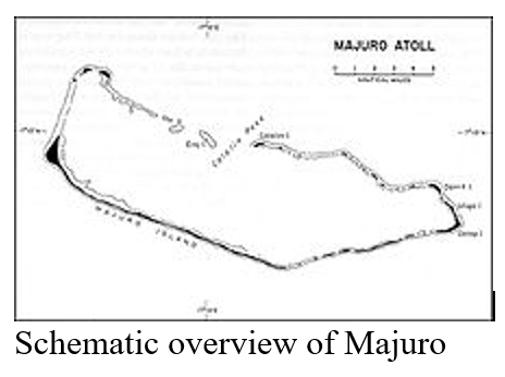
At the western end of Majuro about 30 miles from Delap-Uliga-Djarrit (DUD) by road, is the island community of Laura, a growing residential area with a popular beach. Laura has the highest elevation point on the atoll, estimated at less than 10 feet above sea level. The port where we are docked, Delap, is at a latitude of about 7 degrees north (still in the Northern Hemisphere, but barely) and 171 degrees east.
The Spanish visited Majuro in the 1600s, but it was Germany who in 1884, emulating the other European Countries, established control. They lost this area in 1914 when the Japanese Imperial Navy captured these atolls. In 1920 the League of Nations mandated them to Japan who continued to hold them until 1944 when the US invaded.
When the US arrived they found only one Japanese there, a lieutenant left as a caretaker. Possession of Majuro gave the US Navy one of the largest anchorages in the Central Pacific. The lagoon became a large forward naval base of operations and was for a while the largest and most active port in the Pacific US. When the war moved westward it was supplanted by Ulithi (Yap, Federated States of Micronesia).
Following World War II, the Marshall Islands came under the control of the United States as part of the Trust Territory of the Pacific Islands. Although we were much better than the Japanese our history there is hardly golden. Wanting to test nuclear bombs on a few of these islands we moved the inhabitants to islands which could not sustain them.
In 1986 the Marshall Islands gained independence as the Republic of the Marshall Islands. It is in free association with the United States meaning that we are responsible for their defense. 74,000 folks live in the Republic with 20,000 on Majuro.
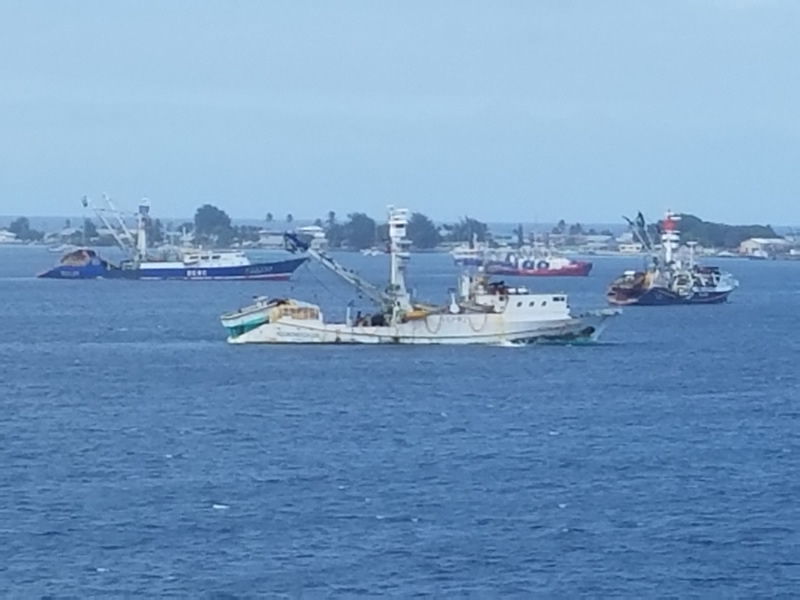
Majuro's economy does not appear too good. The harbor has quite a few ships and there is a container yard at the port, but we saw no evidence of any activity while there.
Along the main road, we saw houses made of shipping containers, often two placed together and covered by a tin roof. One of our group was on a shuttle bus returning to the ship whose driver took them off the main road through one of the wider portions of the atoll. They found a one lane narrow road, with dirt shoulders that allowed cars to pass. In these areas they saw some nice one story homes.
A few of us visited some of the grocery stores. The only meat that I saw for sale was fresh fish. We found a bottle of vodka for $7.50 whose label at first glance was Sminoff, but when the label was looked at closely there was a T instead of an S as the first letter. I didn't buy any...
It's hard to figure out what supports the economy. I have read that it's mostly a service economy, but who are they servicing? There is talk that some entrepreneurs are working to develop a way to turn coconut oil into an alternative fuel. The copra from 6 to 8 coconuts creates one litre of oil.
Water is always a concern. The island water comes from a catchment on the international runway. The threat of drought is commonplace. This source outputs 14 gallons per day per person compared with 118 gallons per person per day in New York City. Consequently water is only available 12 hours a day.
US Dollars are the official currency and English and Marshallese are the official languages of the island. There is an international airport.